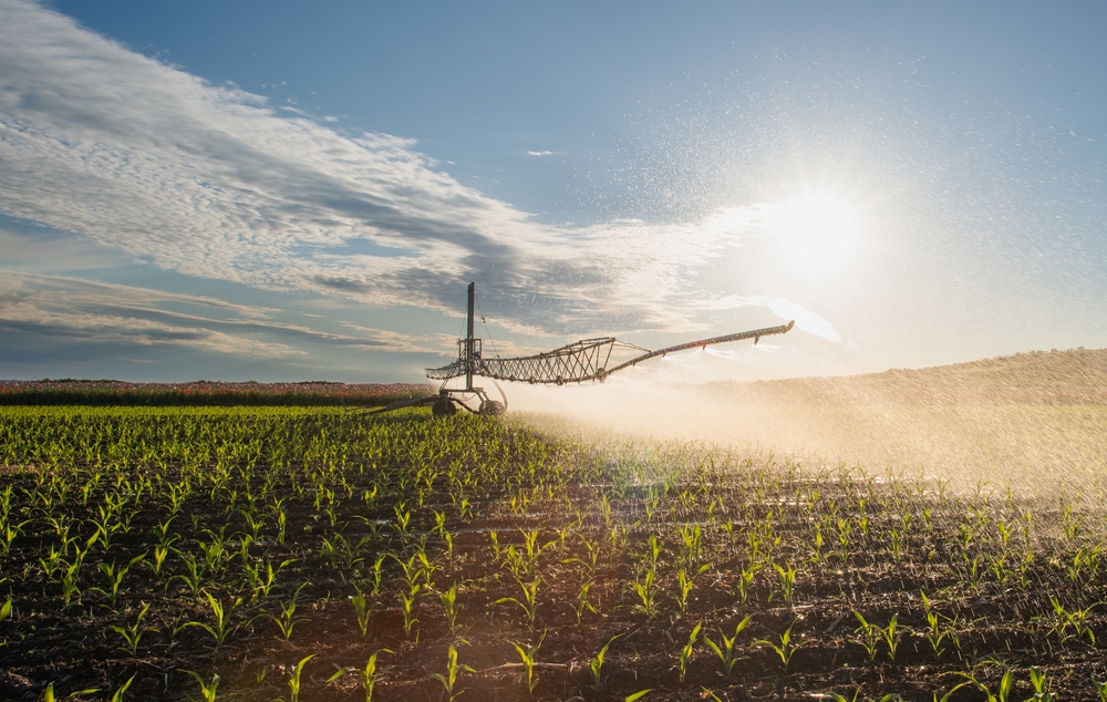
Precision irrigation on alluvial soils of the Lower Danube Floodplain
Water scarcity has become a frequent and widespread phenomenon. Intensification of water scarcity will have an economic impact on the main water-using sectors. The highest pressure on the water resources is exerted by agriculture. Irrigation is the largest consumer of the agriculture sector, and the efficient use of water is of utmost importance.
Precision irrigation, as part of precision agriculture, requires the availability of up-to-date soil water content information and reliable precipitation forecasts. Exploring the untapped potential of assimilating GNSS (Galileo) derived, drone-derived, Copernicus EO-derived datasets and in-situ sensors, the MAGDA project proposes an innovative solution for providing valuable weather and irrigation information directly to farmers and agricultural operators.
One of the selected pilot test areas in the MAGDA project is Brăila County, which has the largest irrigated fields in Romania. By combining satellite-based soil-moisture data, in-situ sensors and high-resolution numerical weather forecast and hydrological modelling, the MAGDA project will deliver valuable information for precision irrigation on the experimental fields owned by Agriculture Research and Development Station Braila.
In the context of precision irrigation, the MAGDA team continuously monitors the changes in soil water content using soil moisture sensors at different depths (5, 25, 50, 75 and 100 cm) on alluvial soils, in close relation to atmospheric and hydrological conditions. In the Embanked Great Island of Danube River, Braila, the capillary rise induced by the water level variation, that is controlled by the Danube water levels, is an important water input for crop water needs between April and June. In this specific area, winter crops are rarely irrigated in the spring due to the high soil water content at 100 cm depth.
In May 2024, the soil moisture at 100 cm depth (Figure 1) has surprisingly started to decrease even though there is no crop consumption. The analysis of the weather and the Danube water level data at Braila showed that the precipitation and temperature regimes were normal, while the Danube water level was below than average starting from March 2024 until first days of June, when usually it records the highest values.
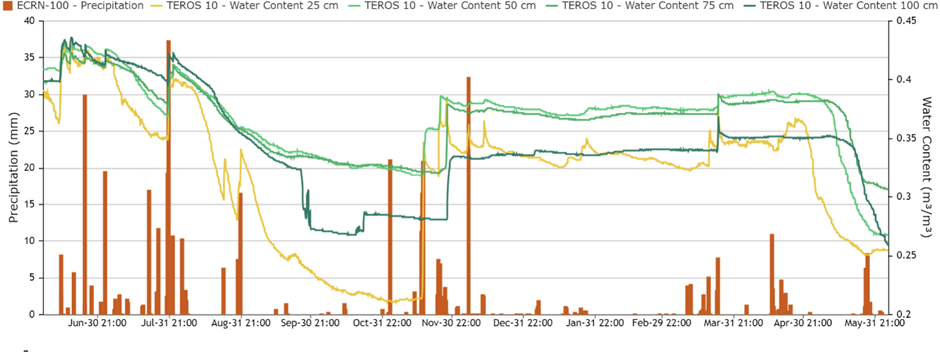
Intensive irrigation applied in May 2024 in the Embanked Great Island of Braila to winter crops, that usually are not irrigated in spring, suggests that drier conditions than average in the Danube River Basin lowered the water level and capillary rise was suppressed for winter cereals in the Lower Danube Floodplain, characterised by low mean annual precipitation (450 mm). Continuous soil water content monitoring combined with improved precipitation forecasts produced into MAGDA project will allow a better water allocation for cereals in the irrigated agriculture.
Links
https://zentracloud.com
Keywords
Precision irrigation, soil moisture monitoring, capillary rise, alluvial soils, Lower Danube Floodplain