New collaboration to build climatic maps of vineyards
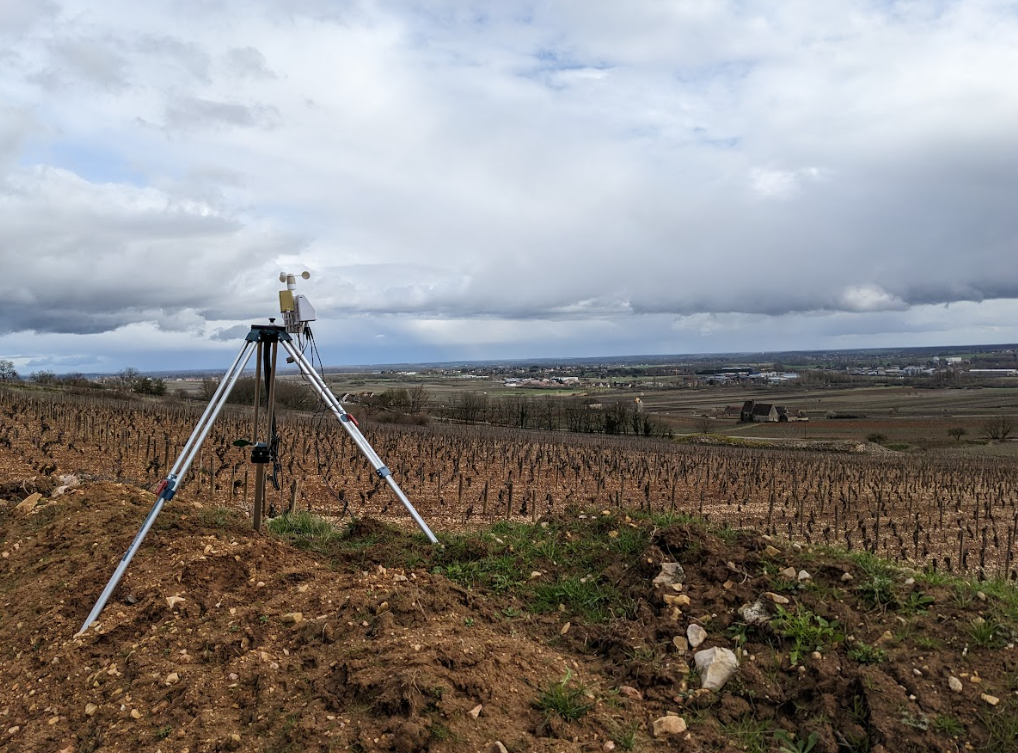
Since 2010, Cap 2020 has been offering agroclimatic services and developed the Hub metIS®, an integral part of the MAGDA project, for multi-scale climatic data measurement (ranging from territorial to intra-plot levels). Cap 2020 employs fleets of modular sensors, characterised by their ease of use and cost-efficiency. This enables the collection of pertinent data at numerous points across territories, enhancing the understanding of local climatic variability. Concurrently, Vineis Projets assists the viticulture sector in developing climate risk management strategies and climate change adaptation methods. Vineis Projets adopts a holistic and interdisciplinary approach, utilizing expertise and tools to bolster the resilience of viticultural operations. During the MAGDA field demonstration, Cap 2020 and Vineis Projets decided to implement finely gridded metIS® hubs to generate a climatic map for a territory spanning nearly 4500 hectares in Southern France, utilizing 85 measurement points. This sensor network will monitor temperature and humidity to develop the topoclimatic zoning of the area, supplemented by meteorological stations measuring precipitation, wind speed and direction, and light flux. Typically conducted over a one-year period, these climatic analyses enhance the understanding of viticultural terroirs and guide vineyard management adaptations in response to climate change (e.g., selection of plant material, modification of technical practices), complementing the advancements in weather forecasting within the MAGDA framework.
Links
Twitter: https://twitter.com/MAGDA_Project
LinkedIn: https://www.linkedin.com/in/magda-project/
Keywords
Climatic map, weather sensors, climate change