Soil moisture: An important variable in agriculture
Why monitoring soil moisture?
Soil moisture is one of the most critical variables for the growth of agricultural crops. An excess or lack of water has direct effects on the crop yield and plant health. In this article it is outlined, which processes depend on soil moisture and how spaceborne technologies can contribute to its measurement.
What is soil moisture?
Water contained in the soil is called soil moisture and if this soil moisture content is at an optimum, plants can absorb the soil water. This availability of water is essential for agricultural crops to grow. However, not all soil water is available to plants. It can be distinguished between surface soil moisture in the upper 10 cm of the soil and root zone soil moisture in the upper 200 cm of the soil layer that is available to plants. Soil moisture is usually measured as volumetric soil water content (SWC). The soil’s ability to retain water is called soil water retention and is strongly related to the soil particle size. For example, water molecules hold more tightly to fine particles of a clay soil but have a high transmission in sandy or gravel soils. The total water retention capacity of soil is also determined by soil depth, organic material and air content, hence natural and healthy soils can usually store more water.
Why is soil moisture a critical variable in agriculture?
Soil moisture is critical for various chemical and physical processes:
- The water in the soil serves as a solvent and carrier of minerals and organic materials needed for plant growth
- Regulates the soil temperature, soil pH, and soil air content
- Important microorganisms that convert plant material into soil nutrients require water for their metabolic activities
- Water is essential for crop photosynthesis
- Plays an important role in the development of local weather patterns and precipitation as surface soil moisture can be returned directly to the atmosphere by evaporation and the evapotranspiration of plants
- The water retention in soils is avoiding flooding as the soil acts as part of a storage system that regulates the passage of water from rainfall to aquifers and streams
- Soil moisture information can be used as an indicator for early warning of droughts
How is remote sensing contributing to soil moisture measurements?
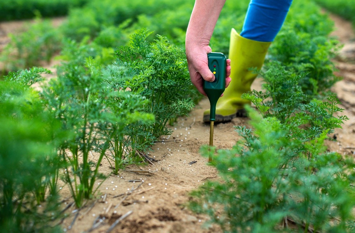
Knowing the soil moisture enables farmers to deploy an efficient irrigation management, providing the irrigation water when required and saving water when irrigation is not required. Soil moisture can be determined directly and indirectly by various numerous quantitative techniques (Rasheed et al. 2022), targeting different scales and soil depths.
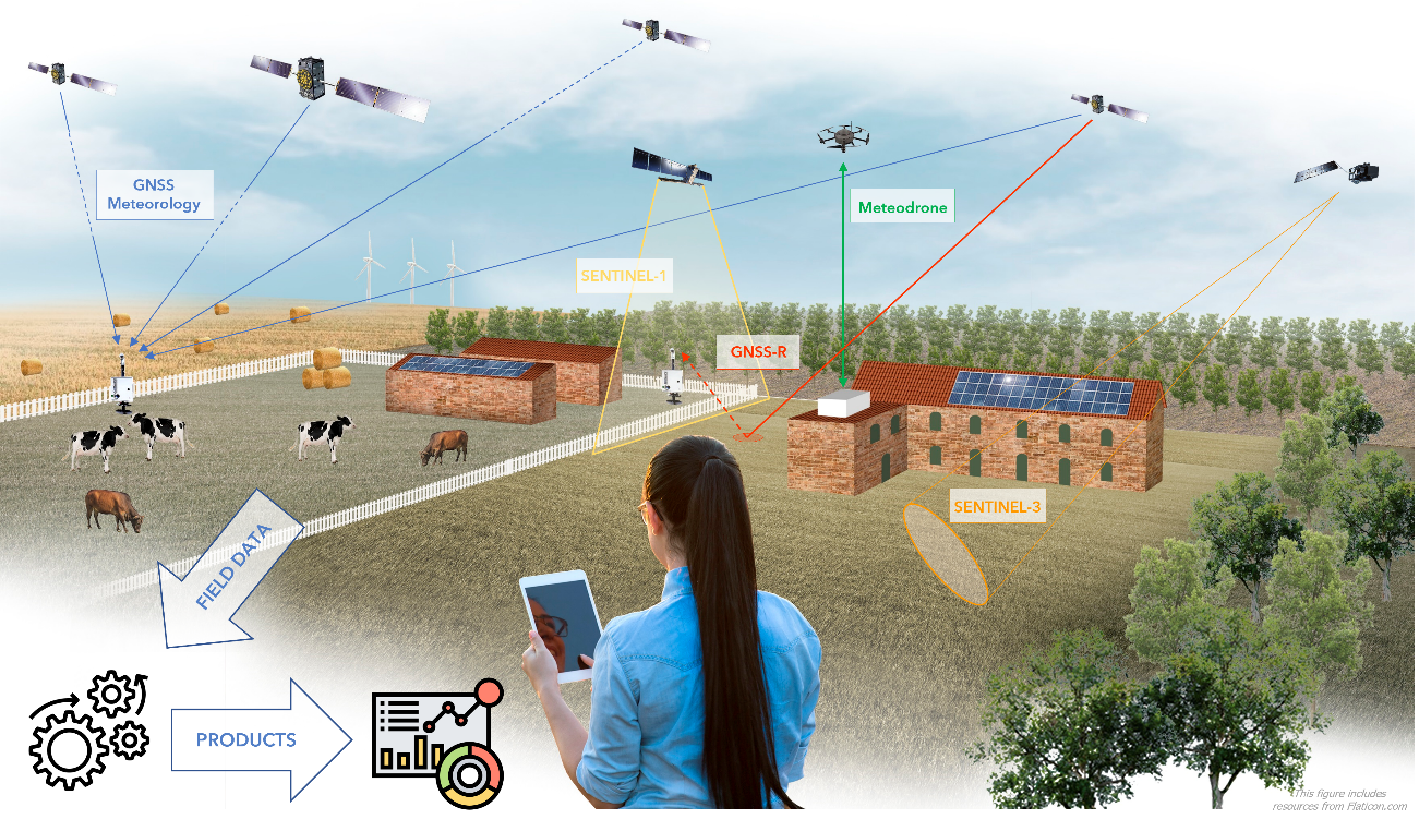
A modern method, which is targeting large soil moisture observation scales is to obtain soil moisture from satellite sensors, which are either radar or microwave sensor-based, or also radar imagery-based. Satellite-based soil moisture data by Copernicus, which is the Earth Observation component of the European Union’s space programme is providing two products of soil moisture measurements: One of the products, Surface Soil Moisture, shows the relative water content in the top few centimetres of soil (usually up to 5 or 7 cm) expressed in percent saturation. It is measured by satellite radar sensors and allows insights in local precipitation impacts and soil conditions (Copernicus 2022a). The second product is the Soil Water Index, which quantifies the moisture condition at various depths in the soil. It is provided at 1 km resolution over Europe, and 0.1 degree, or 12.5 km resolution, at the global scale, on a daily basis, in near-real time (Copernicus 2022b).
According to a recent study by Gałęzewski et al. 2021, 96 % of agricultural producers in Poland stated that soil moisture is an important variable, however only about 4% of the surveyed farmers have the equipment or information to evaluate this soil parameter. The study revealed that mostly technical problems related to the operation and servicing of such equipment were the most frequently mentioned impediments in their use. This issue maybe similar in other European countries, like Italy, France and Romania, and this is why the MAGDA project is also analysing the user needs of farmers in other European countries in order to facilitate and integrate the use of spaceborne information from Galileo and Copernicus into existing Farm Management Systems.
Author: Janine Halder and Roland Reiter
References
[1] Civeira, G. (ed.) (2019). Soil Moisture. IntechOpen. DOI: 10.5772/intechopen.73742
[2] Copernicus (2022a). Surface Soil Moisture. [Online] Copernicus Global Land Service. Available at: https://land.copernicus.eu/global/products/ssm
[3] Copernicus (2022b). Soil Water Index. [Online] Copernicus Global Land Service. Available at: https://land.copernicus.eu/global/products/swi
[4] Gałęzewski, L., Jaskulska, I., Jaskulski, D. (2021). Analysis of the need for soil moisture, salinity and temperature sensing in agriculture: a case study in Poland. Sci Rep 11, 16660. https://doi.org/10.1038/s41598-021-96182-1
[5] Rasheed, M.W.; Tang, J.; Sarwar, A.; Shah, S.; Saddique, N.; Khan, M.U.; Imran Khan, M.; Nawaz, S.; Shamshiri, R.R.; Aziz, M.; Sultan, M (2022). Soil Moisture Measuring Techniques and Factors Affecting the Moisture Dynamics: A Comprehensive Review. Sustainability, 14, 11538. https://doi.org/10.3390/su141811538
Keywords
Soil moisture, soil water, soil nutrients, agriculture, soil moisture monitoring, Copernicus, spaceborne