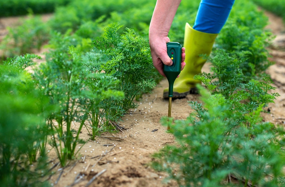
Discover how MAGDA is supporting farmers with precise weather forecasts for different purposes. By integrating advanced data from satellites, drones, and ground-based sensors, MAGDA ensures better crop management and water usage—enhancing sustainability and food security across Europe.
The MAGDA project improves agricultural forecasting by integrating satellite, drone, and ground sensor data into high-resolution models that deliver real-time, localized weather predictions and practical irrigation advice. With successful demonstration studies in Italy, Romania, and France, MAGDA empowers farmers to optimize water use and safeguard crops, paving the way for sustainable, data-driven farming practices.
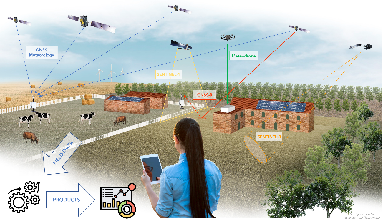
The MAGDA project represents an innovation in meteorological forecasting and irrigation management for the agricultural sector, providing detailed information and practical advice directly to farmers. By integrating data from satellites, drones, and ground-based sensors, the MAGDA system processes meteorological and hydrological information using high-resolution numerical models alongside a dedicated hydrological model. This integrated approach enables the prediction of extreme weather events and translates them into actionable guidance for crop management and water resource use. At its core, the project relies on data assimilation techniques that continuously correct the initial state of the numerical models by incorporating real-time observations. This process reduces bias and limits uncertainty propagation in the forecasts, resulting in localized, highly accurate predictions that can issue timely warnings for severe events—such as convective storms, frosts, or heatwaves—and optimize irrigation strategies based on actual field conditions.
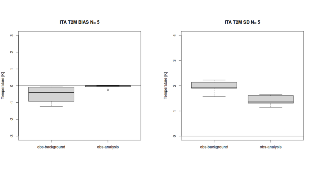
During the demonstration phase, in-depth studies were conducted in various geographic contexts, including Italy, Romania, and France, each with specific operational goals. In the Italian demonstration, the focus was on irrigation guidance during a summer period characterized by light rainfall forecasts. In a five-day simulation, the system utilized measurements of 2-meter temperature, radar reflectivity data, and GNSS information to correct the numerical model. The data assimilation process significantly reduced forecasting errors—both in terms of bias and error dispersion—making the estimates more reliable.
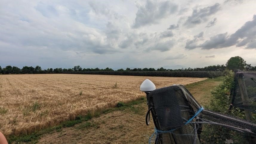
In the Romanian demonstration, the approach, focused always on irrigational purposes, was on refining local weather forecasts through repeated assimilation cycles of temperature, humidity, and radar reflectivity data, supplemented by high-resolution vertical profiles obtained from drone flights. The results revealed that the model initially experienced an oscillation in bias—with an initial overestimation followed by a slight underestimation—before gradually stabilizing towards more accurate values. This iterative correction process demonstrates how continuous assimilation effectively minimizes errors and restricts the spread of uncertainty over time. Such precise local atmospheric estimates are crucial for effective water management, enabling timely and informed interventions on the ground.
Figure 1 is an example illustrating the boxplots of the bias (on the left) and the standard deviation (on the right) of the 2-meter temperature (T2M) for a sample of five cases, comparing the “obs-background” and “obs-analysis” values over the Italian domain.
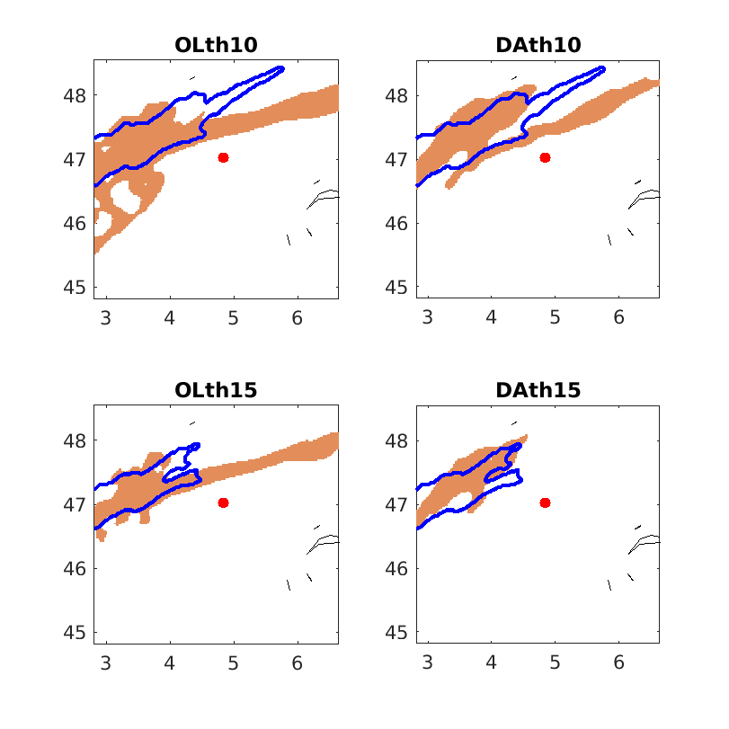
In France, the case studies aimed to enhance forecasts of convective storms and validate the predicted rainfall cells in the area of interest. The simulations were carried out in a nowcasting framework, with short-term forecasts spanning 12 to 24 hours—essential for anticipating convective events like summer thunderstorms. In these experiments, the WRF model was run in two configurations: one in Open Loop (OL), where the model runs without data assimilation, and one using Data Assimilation (DA), where observations collected at 06, 09, and 12 UTC are integrated before initiating a free forecast from 12 to 24 UTC. The assimilated data included 2-meter temperature measurements from in-situ thermometers, GNSS-derived Zenith Total Delay (ZTD), and vertical profiles from meteodrone flights. Although the rainfall events analyzed were not particularly intense, the assimilation process significantly improved the spatial localization of the rainfall cells, reducing false alarms and increasing overall forecast precision. Sensitivity tests using MODE—where parameters such as radius, thresholds, and merging options were varied—helped define an optimal configuration that best matched the forecasted rain areas with the observed ones. This precise localization is vital for providing farmers with accurate, timely information that can be directly translated into operational actions to protect their crops and manage irrigation effectively.
Figure 2 is an example illustrating four panels comparing open-loop (OL) and data-assimilation (DA) configurations at two different rainfall thresholds (10mm and 15mm), showing how the precipitation spatial distribution varies after data assimilation procedure.
Overall, the results obtained from the various demonstrations clearly indicate that integrating data from multiple sources and applying advanced assimilation techniques lead to a substantial reduction in numerical model errors. The MAGDA system proves capable of correcting the initial state of the models in real time, reducing bias and limiting the propagation of uncertainty. This not only improves the accuracy of meteorological and hydrological forecasts but also provides farmers with reliable information for making informed decisions about irrigation and crop protection. In an era marked by increasing climate variability and extreme weather events, the innovation brought by MAGDA is a major step forward—it offers a tool that delivers both high-quality, localized forecasts and actionable advice, ultimately supporting sustainable water management and enhancing food security across Europe.
With further developments and an expanded sensor network, the MAGDA system can be further refined to improve data integration and forecast accuracy. Such advancements will pave the way for a fully operational tool that can be directly implemented by agricultural businesses and farmer associations, providing highly precise, localized forecasts tailored to their specific needs. This innovative approach transforms complex meteorological data into practical, immediately usable insights, opening new prospects for the future of agriculture—where forecast accuracy becomes essential for resource optimization and resilience against extreme weather events.
In summary, the MAGDA project offers an advanced, integrated solution that combines state-of-the-art atmospheric and hydrological monitoring with cutting-edge technology. By providing critical information and practical guidance directly to the agricultural sector, MAGDA supports daily and strategic decision-making, enhances sustainable water management, and contributes significantly to food security in Europe. This innovative system not only improves the ability to anticipate extreme weather events but also marks a revolutionary advance in the way meteorological information is utilized in agriculture, making precise forecasts an indispensable tool for optimizing resources and ensuring resilience in the face of climatic challenges.